Astronomical Time within Clava Cairns

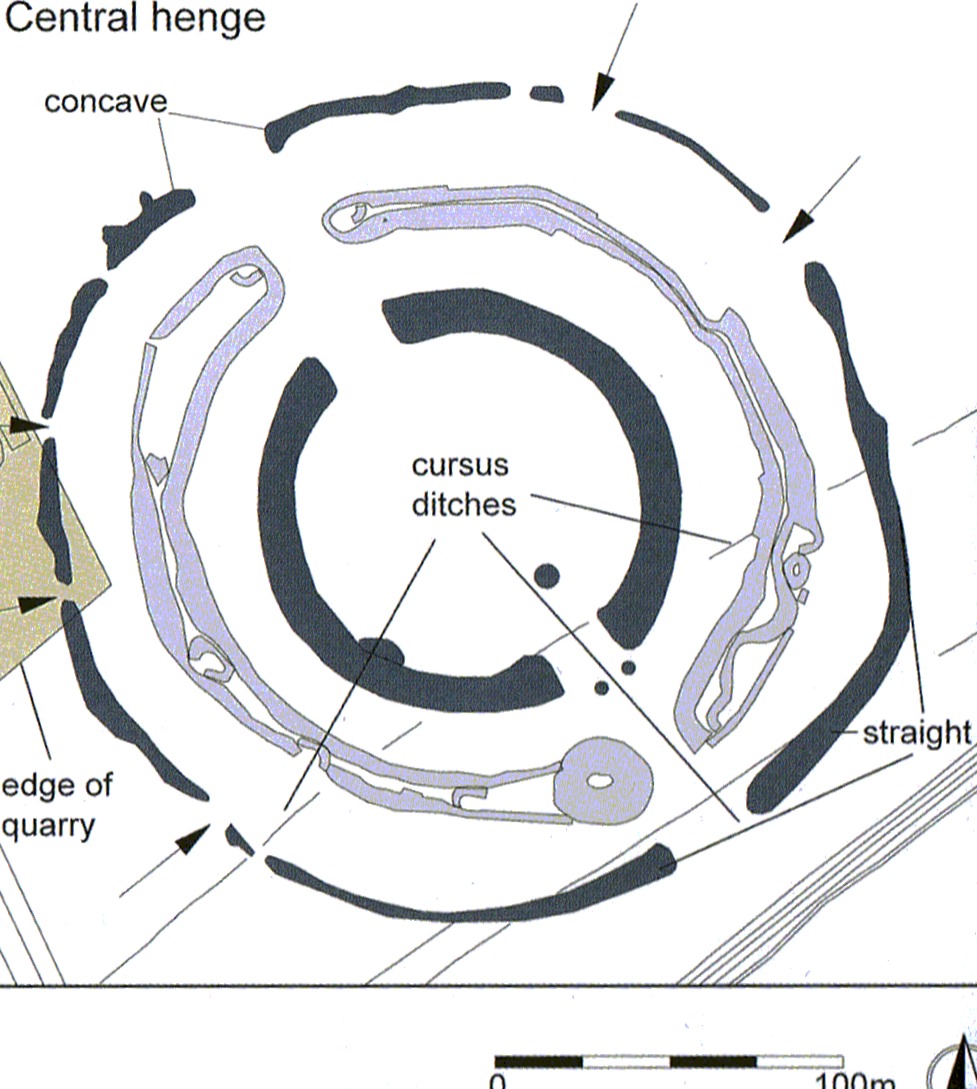
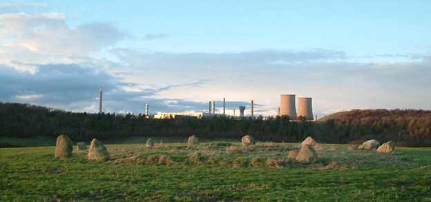
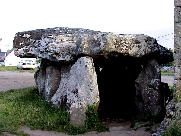
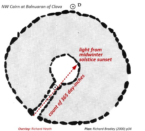
In North East Scotland, near Inverness, lies Balnuaran of Clava, a group of three cairns with a unique and distinctive style, called Clava cairns; of which evidence of 80 examples have been found in that region. They are round, having an inner and outer kerb of upright stones between which are an infill of stones. They may or may not have a passageway from the outer to the inner kerb, into the round chamber within. At Balnuaran, two have passages on a shared alignment to the midwinter solstice. In contrast, the central ring cairn has no passage and it is staggered west of that shared axis.

This off-axis ring cairn could have been located to be illuminated by the midsummer sunrise from the NE Cairn, complementing the midwinter sunset to the south of the two passageways of the other cairns. Yet the primary and obvious focus for the Balnuaran complex is the midwinter sunset down the aligned passages. In fact, the ring cairn is more credibly aligned to the lunar minimum standstill of the moon to the south – an alignment which dominates the complex since, in that direction the horizon is nearly flat whilst the topography of the site otherwise suffers from raised horizons.

Cairns at Balnuaran of Clava. plan by A. Thom and pictures by Ian B. Wright
Continue reading “Astronomical Time within Clava Cairns”

Models of Time within Henges and Circles

image: composite, see figure 1 below

Presenting important information clearly often requires the context be shown, within a greater whole. Map makers often provide an inset, showing a larger map at a smaller scaling (as below, of South America) within a detailed map (of Southern Mexico).

This map is shown in the context of South America with a yellow rectangle which is the part blown up in scale. The subject is the Quetzal birds range which corresponds well to the Olmec then Maya heartlands leading to the god named Quetzalcoatl or Feathered Serpent. (see chapter 8 of Heath, 2018.)

Megalithic astronomy generated maps of time periods, using lines, triangles, diameters and perimeters, in which units of measure represented one day to an inch or to a foot. To quantify these periods, alignments on the horizon pointing to sun and moon events were combined with time counting between these events,where days, accumulated as feet or inches per day, form a counted length. When one period was much longer than another, the shorter could be counted in feet per day and the smaller in inches per so that both counts could share the same monumental space. In this article we find the culture leading to megalithic astronomy and stone circles, previously building circular structures called henges, made of concentric banks and ditches.

Thornborough Henge
Continue reading “Models of Time within Henges and Circles”

Palsson’s Sacred Image in Iceland

Extracted from The Structure of Metrology, its Classification and Application (2006) by John Neal and notes by Richard Heath for Bibal Group, a member of which, Petur Halldorsson, has taken this idea further with more similar patterns on the landscape, in Europe and beyond. Petur thinks Palsson’s enthusiasm for Pythagorean ideas competed with what was probably done to create this landform, as he quotes “Every pioneer has a pet theory that needs to be altered through dialogue.” Specifically, he “disputes the Pythagorean triangle in Einar’s theories. I doubt it appeared in the Icelandic C.I. [Cosmic Image] by design.” Caveat Emptor. So below is an example of what metrology might say about the design of this circular landform.


Figure 1 of Palsson’s (1993) Sacred Geometry in Pagan Iceland
Continue reading “Palsson’s Sacred Image in Iceland”

Thornborough Henge as Moon’s Maximum Standstill

The three henges appear to align to the three notable manifestations to the north west of the northerly moon setting at maximum standstill. The distance between northern and southern henge entrances could count 3400 days, each 5/8th of a foot (7.5 inches), enabling a “there and back again” counting of the 6800 days (18.618 solar years/ 19.618 eclipse years) between lunar maximum standstills.

Figure 1 The three henges are of similar size and design, a design most clear in what remains of the central henge. [photo: Iain Petrie]
Continue reading “Thornborough Henge as Moon’s Maximum Standstill”

Harmonic Astronomy within Seascale Flattened Circle

first published in July 2018

Only two type-D stone circles (see figure 3) are known to exist, called Roughtor (in Cornwall) and Seascale (in Cumbria). Seascale is assessed below, for the potential this type of flattened circle had to provide megalithic astronomers with a calendrical observatory. Seascale could also have modelled the harmonic ratios of the visible outer planets relative to the lunar year. Flattened to the north, Seascale now faces Sellafield nuclear reprocessing plant (figure 1).


Figure 1 Seascale type-D flattened circle and neighbouring nuclear facility.
photo: Barry Teague

Stone Age astronomical monuments went through a series of evolutionary phases: in Britain c. 3000 BC, stone circles became widespread until the Late Bronze Age c. 1500 BC. These stone circles manifest aspects of Late Stone Age art (10,000 – 4500 BC) seen in some of its geometrical and symbolic forms, in particular as calendrical day tallies scored on bones. In pre-literate societies, visual art takes on an objective technical function, especially when focussed upon time and the cyclic phenomena observed within time. The precedent for Britain’s stone circle culture is that of Brittany, around Carnac in the south, from where Megalithic Ireland, England and Wales probably got their own megalithic culture.

Continue reading “Harmonic Astronomy within Seascale Flattened Circle”

Lunar Counting from Crucuno Dolmen to its Rectangle

A fuller treatment of this article can now be found in
Sacred Geometry: Language of the Angels (2021).

Figure 1 The entrance of Crucuno’s cromlech, which opens to the south-east
[Summer Solstice, 2007]

It is not immediately obvious the Crucuno dolmen (figure 1) faces the Crucuno rectangle about 1100 feet to the east. The role of dolmen appears to be to mark the beginning of a count. At Carnac’s Alignments there are large cromlechs initiating and terminating the stone rows which, more explicitly, appear like counts. The only (surviving) intermediate stone lies 216 feet from the dolmen, within a garden and hard-up to another building, as with the dolmen (see figure 2). This length is interesting since it is twice the longest inner dimension of the Crucuno rectangle, implying that lessons learned in interpreting the rectangle might usefully apply when interpreting the distance at which this outlier was placed from the dolmen. Most obviously, the rectangle is 4 x 27 feet wide and so the outlier is 8 x 27 feet from the dolmen.

Continue reading “Lunar Counting from Crucuno Dolmen to its Rectangle”