image: composite, see figure 1 below
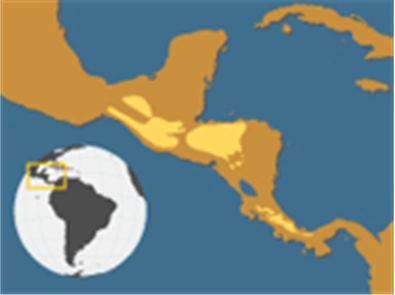
Presenting important information clearly often requires the context be shown, within a greater whole. Map makers often provide an inset, showing a larger map at a smaller scaling (as below, of South America) within a detailed map (of Southern Mexico).
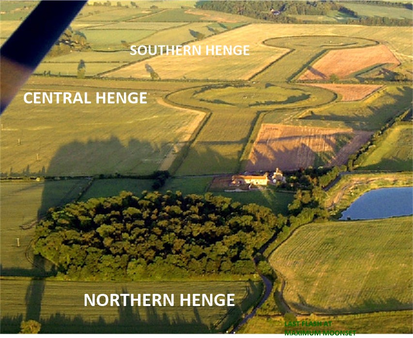
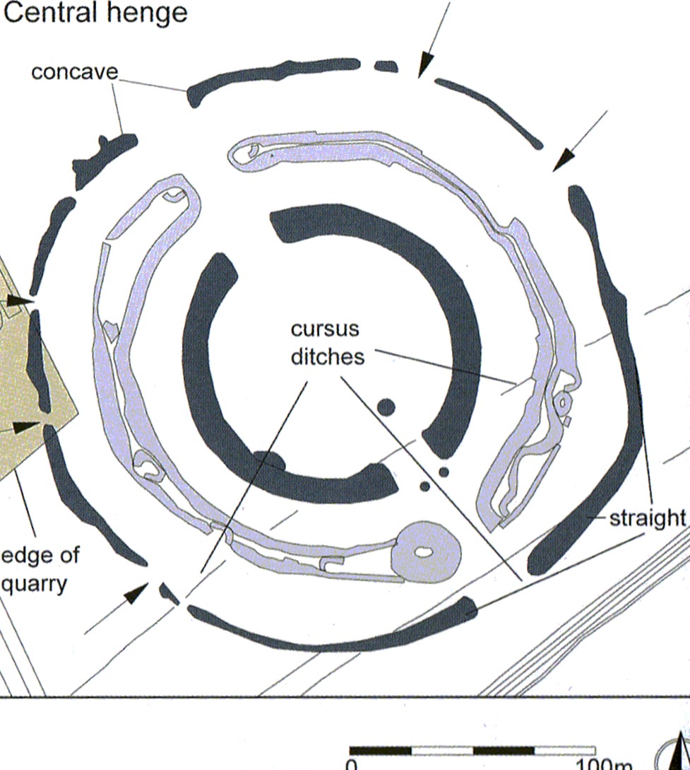
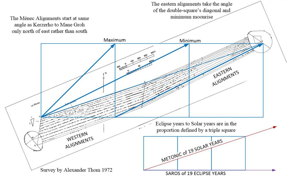
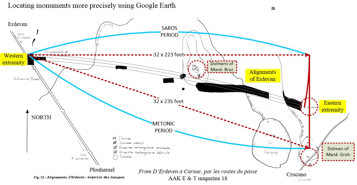
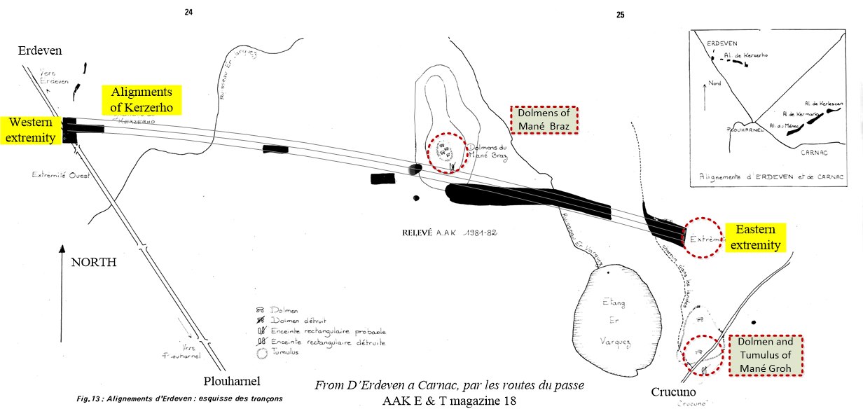
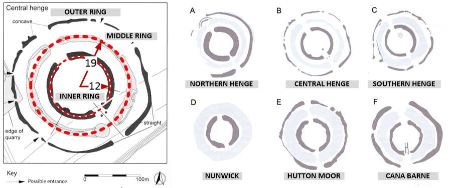
Megalithic astronomy generated maps of time periods, using lines, triangles, diameters and perimeters, in which units of measure represented one day to an inch or to a foot. To quantify these periods, alignments on the horizon pointing to sun and moon events were combined with time counting between these events,where days, accumulated as feet or inches per day, form a counted length. When one period was much longer than another, the shorter could be counted in feet per day and the smaller in inches per so that both counts could share the same monumental space. In this article we find the culture leading to megalithic astronomy and stone circles, previously building circular structures called henges, made of concentric banks and ditches.